Research Overview
My research lies at the intersection of Geospatial Artificial Intelligence (GeoAI), Vision–Language Models (VLMs), and Urban Sustainability. I explore how multimodal data—including imagery, text, and spatial data—can help understand urban perception, environmental quality, and human–environment interaction.
I currently focus on developing interpretable and responsible AI systems for real-world geospatial applications.
Major Research Projects
Selected projects based on my current and recent work in GeoAI, multimodal learning, and open-source urban analytics.
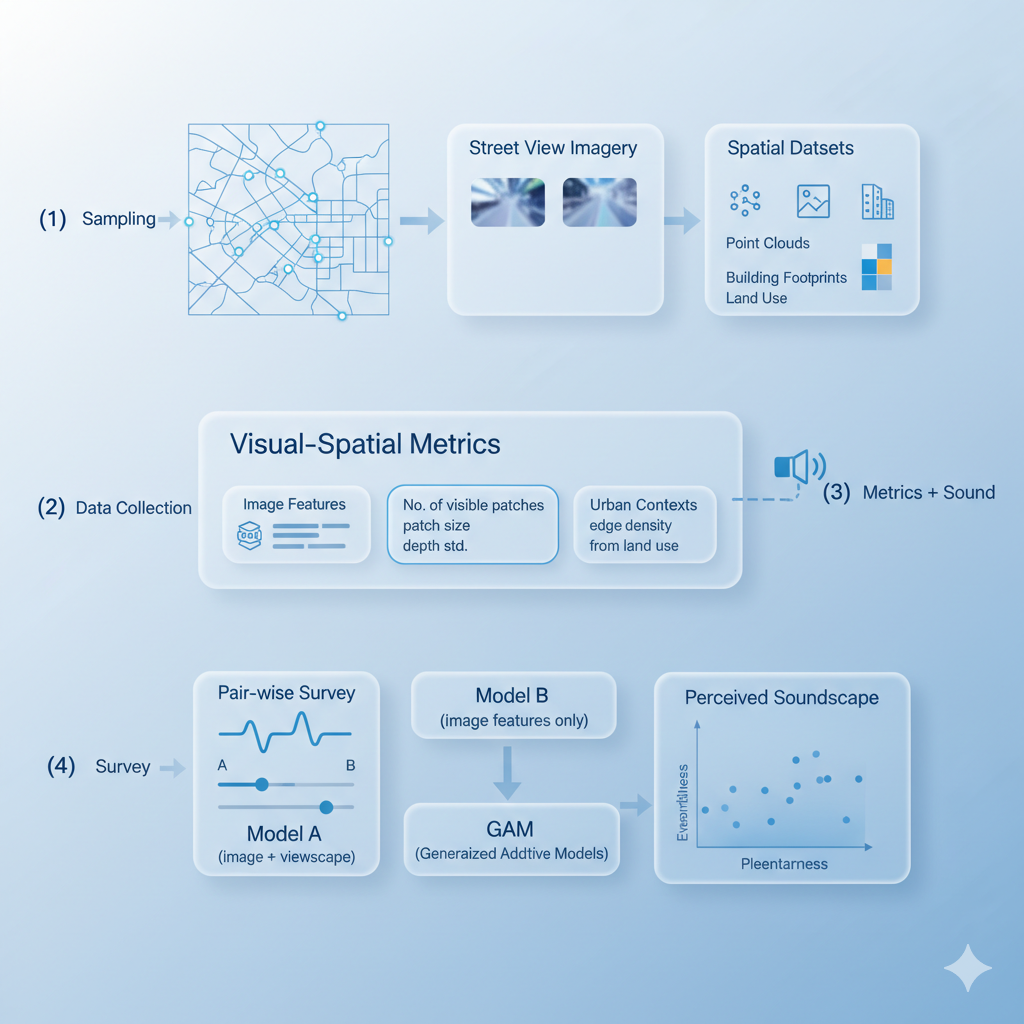
We model perceived soundscapes by linking visual–spatial metrics from street-view imagery and spatial data with human perceptions of urban acoustics. Using Detroit as a case study, we extract image features and viewscape metrics to represent the visual context, and fit non-linear GAMs to relate these spatial features to affective responses (eventfulness and pleasantness).
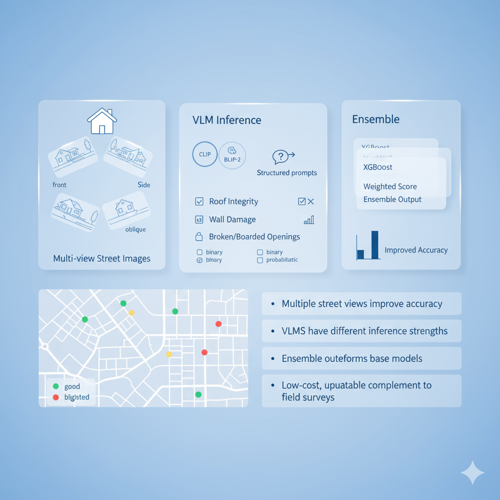
A scalable framework using open-source large VLMs with multi-view street images to assess residential housing conditions in Detroit. Structured prompts guided models to evaluate roof integrity, wall damage, and boarded openings. Ensemble learning (e.g., XGBoost stacking) improved robustness and accuracy across all conditions. This approach enables low-cost, regularly updatable tracking of urban blight as a complement to traditional field surveys.
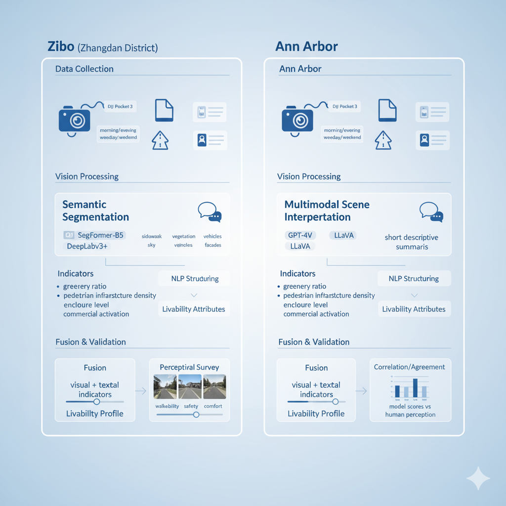
We develop a multimodal framework that integrates street-level imagery, deep vision segmentation, and language-based interpretation to analyze urban livability. A comparative study between Zibo and Ann Arbor examines how visual and textual features reflect differences in walkability, safety, and comfort across urban contexts.
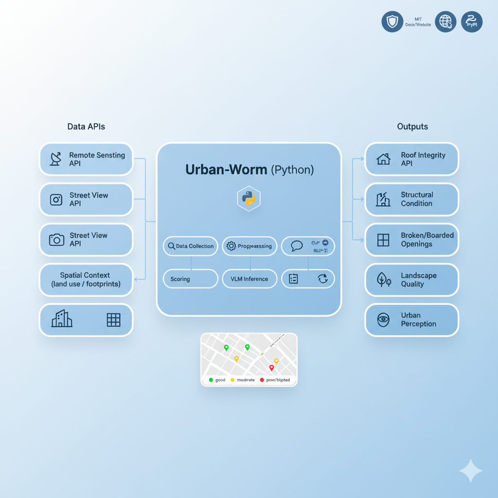
Urban-Worm is a Python library that integrates remote sensing imagery, street-view data, and vision–language models to assess urban units. The package provides APIs for data collection and VLM-based inference, supporting automated evaluation of roof integrity, structural condition, broken/boarded openings, landscape quality, and urban perception. It is designed for scalable, repeatable urban analytics workflows. View Project on GitHub.
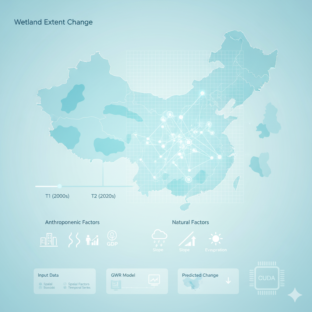
We quantify two decades of wetland loss across China and analyze key drivers using an innovative Grid-GWR-CUDA framework. The model integrates natural factors (e.g., precipitation, elevation, slope) and socioeconomic variables (e.g., population, GDP, distance to cities/roads) to reveal spatial heterogeneity in wetland decline. GPU-accelerated computation enables fine-resolution modeling and efficient national-to-regional analysis, highlighting human activities as the dominant cause of loss. Read Paper .
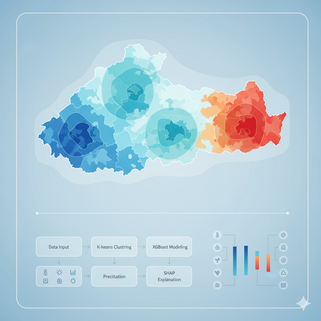
We investigate glacier melting patterns across the Tibetan Plateau using K-means clustering and XGBoost–SHAP modeling. The workflow identifies three distinct glacier clusters driven by temperature, sunshine hours, evapotranspiration, and terrain factors. SHAP interpretation quantifies each feature’s contribution, revealing the dominant role of surface temperature and solar radiation in driving regional melting heterogeneity. Read Paper .
Research Impact
My work advances explainable and responsible GeoAI by linking multimodal urban data with human perception. The resulting tools and frameworks support scalable, updatable, and human-aligned analytics for planners and policymakers.